
blah blah blah
Sawyer Ponds
Length: 3.3 miles out-and-back with loopDifficulty (click for info): Easy
Elevation Gain: 430 feet
Rating (click for info): 7/10
Elevation: 1936'
Driving Directions:
Trailhead and parking area are on Sawyer River Road in Livermore, NH. (Seasonal road - check status on TrailsNH to verify gate status). Sawyer River Road takes off the south side of Rt. 302 in Harts Location, 10.1 miles west of Rt. 16 and 19.0 miles south of Rt. 3. Follow this narrow dirt road 3.7 miles to its end at the parking area. Click here for a Google map.
About the Hike:
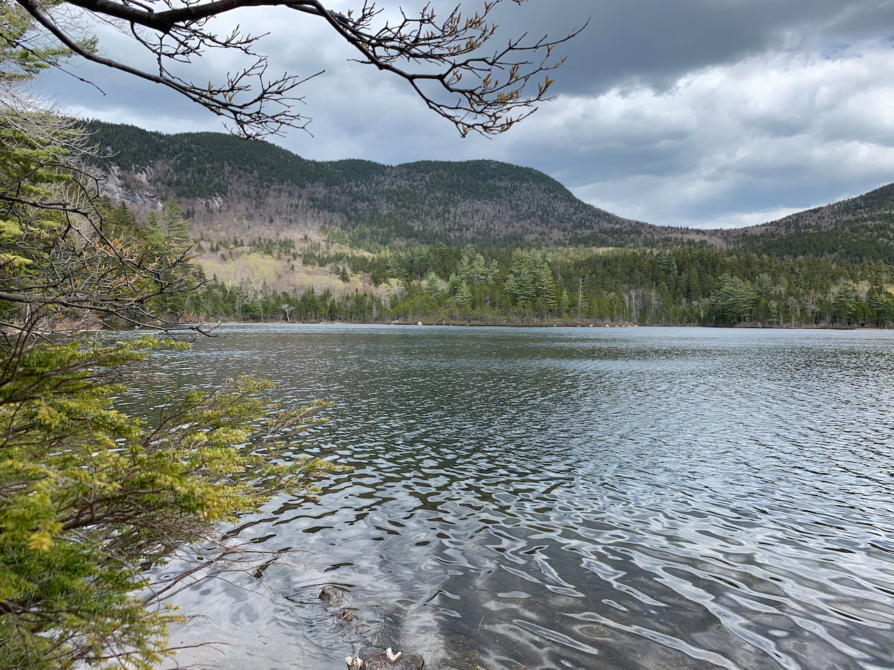
The secluded Sawyer Ponds are a longtime White Mountain favorite for a variety of activities - fishing, camping, picnicking, kayaking, and of course hiking. The two ponds are located in a remote, circular valley, enclosed by the long arms of Mt. Tremont. Idyllic views are had from the shore of the big pond, a place which entices one to spend more time than planned. For hikers, there are a multitude of spots along the water to relax and take in the towering ridges on all sides. The brief and mostly gentle jaunt on the Sawyer Pond Trail is pleasureful, and the side trip to Little Sawyer Pond is a worthwhile detour.
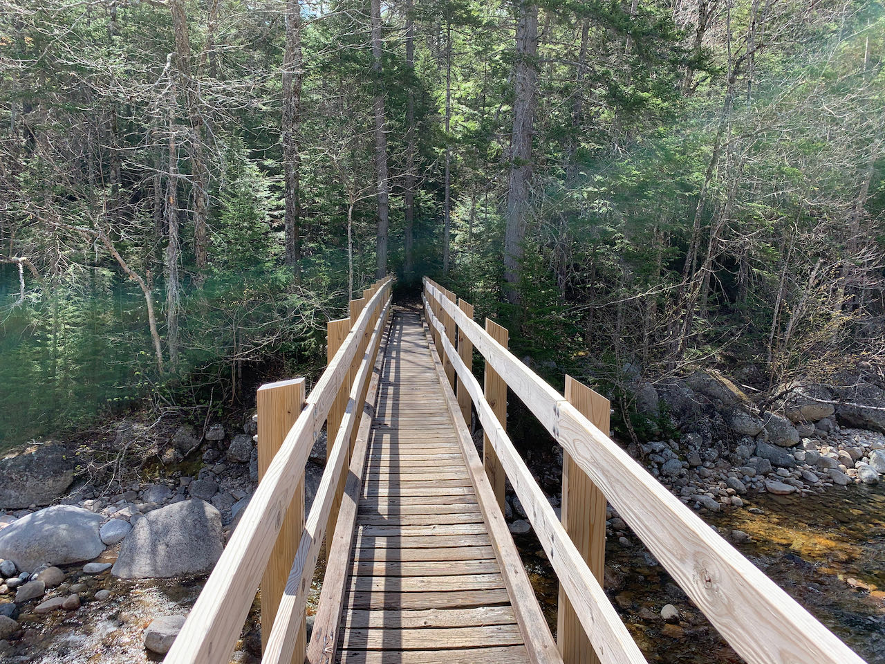
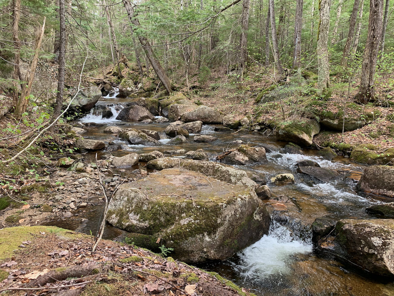
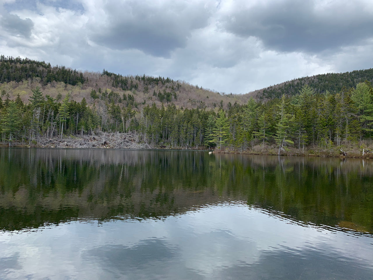
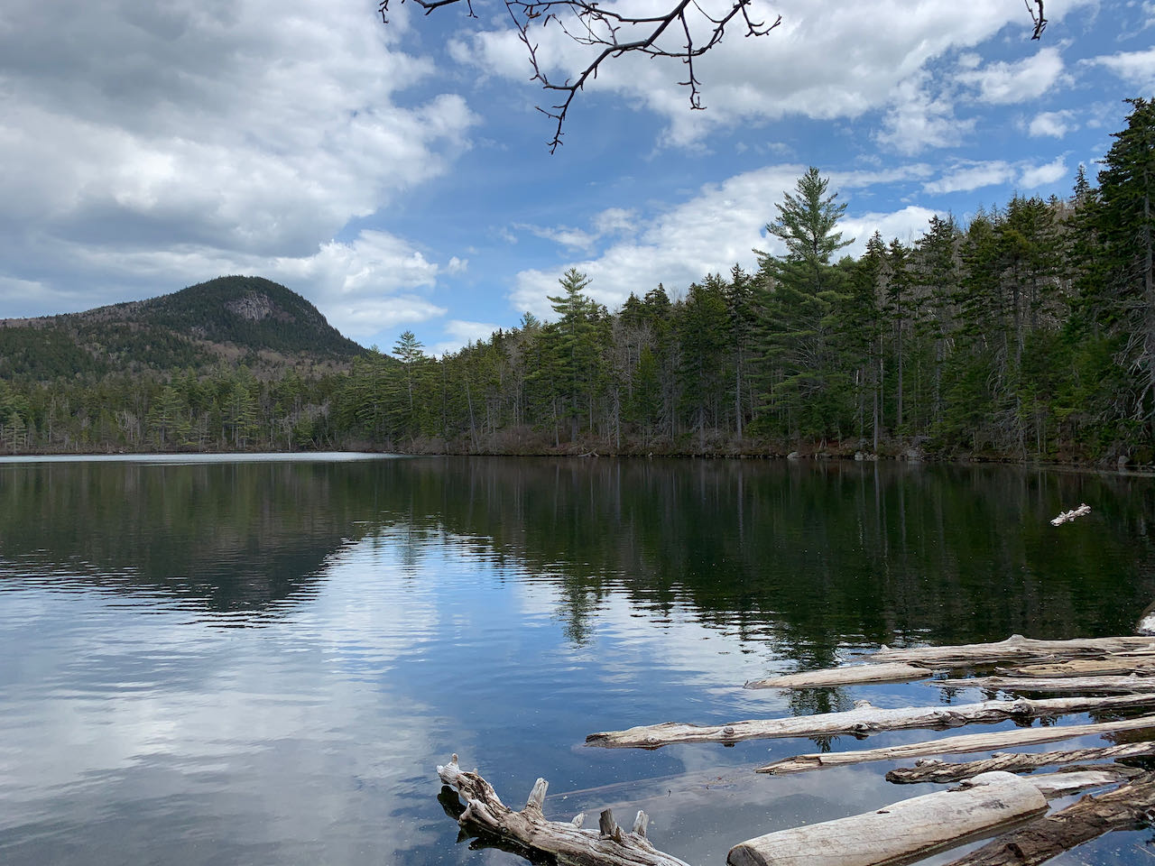
Begin your hike by continuing down the dirt road from the parking area, passing the gate and kiosk. Turn left onto Sawyer Pond Trail and cross a sturdy bridge over the Sawyer River, a delightful, bouldery watercourse. Entering the forest on the opposite bank, the trail winds up a stone staircase and begins its gradual ascent. In 0.3 miles, it crosses another bridge over the nameless brook draining the ponds. The trail then closely follows the brook for a quarter mile, passing small cascades and rapids and a few boulders before turning away. It continues the slight climb through the forest for the next 0.6 miles, crossing a few small brooks and passing through sections of occasional mud, before again approaching the brook. After a short distance nearby the marshy headwaters of the brook, the trail forks. Bear left onto the loop trail through the maze of campsites. Soon, bear left again and descend to the shelter at the waterside of the big pond. Several openings afford views across the tranquil waters to the looming profile of Mt. Tremont and its deep, curving ridge across to the sharp dome of Owl's Cliff. Many ledges and openings can be glimpsed atop the mountain, including the summit ledge on Tremont. Scattered herd paths continue along the shoreline, offering many options for a picnic spot, and encircle the entire pond. Take a quick side trip from here to pay a visit to the smaller pond. Just past the shelter, follow the trail steeply uphill past the outhouse and bear right onto a narrow fisherman's path. It crosses the hillside and leads to the tiny brook linking the two ponds. The clearest path crosses the brook and leads to an opening on the shore well overlooking the entire pond. Even more beaten paths diverge and explore the area. No great mountain views are found here, but it remains a peaceful spot. To head back, return to the shelter and turn right along the loop trail. Follow the main path along the shore for just over 0.1 miles, passing many other campsites, to a junction at the outlet of the pond. A slightly different perspective of the pond is found here. When you're ready to start back, turn right on the main Sawyer Pond Trail (straight across the brook is the little-used southern approach from the Kancamagus Highway) as it heads downhill for a brief 0.1 mile to the first fork. Now follow the trail back the way you came.
Printable directions page